

THE TRUE SMART LEVEL WITH BLUETOOTH HAS ARRIVED
WATCH THE SMART LEVEL WORK
DOWNLOAD THE LATEST APP FREE!
NO MATH OR FIGURING
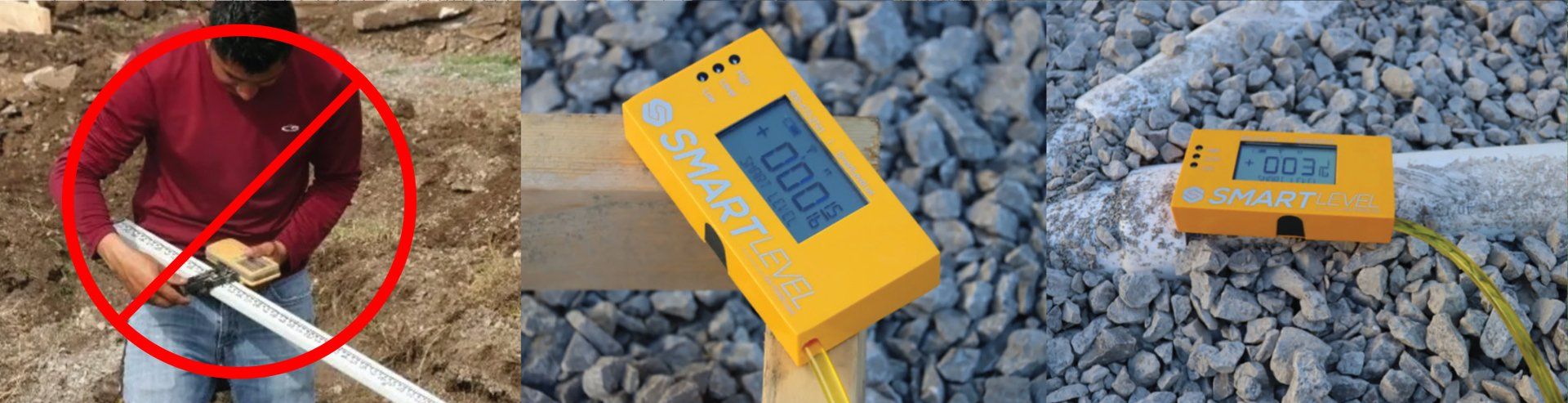
THE SMART LEVEL WORKS AROUND OBSTRUCTIONS

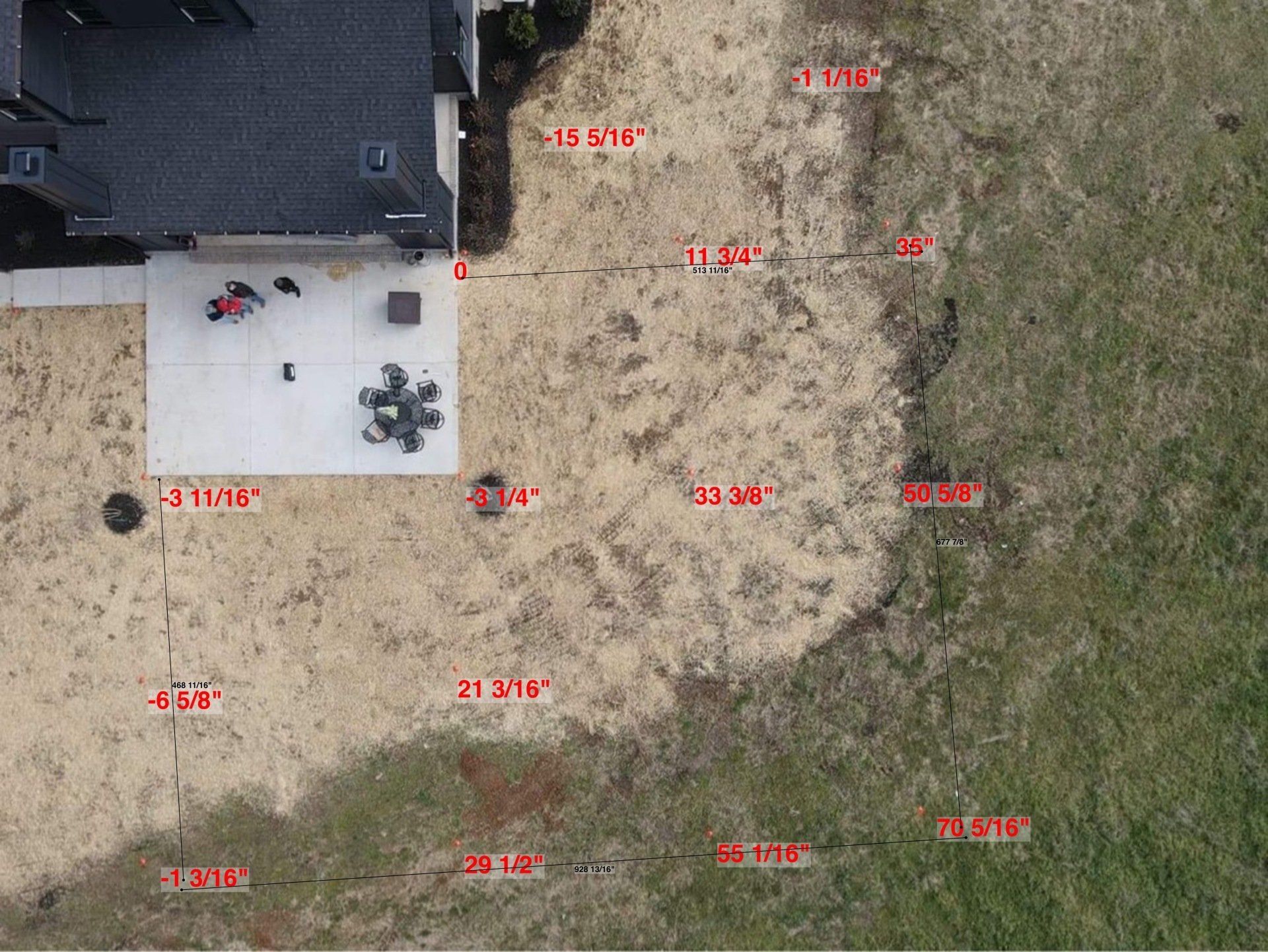
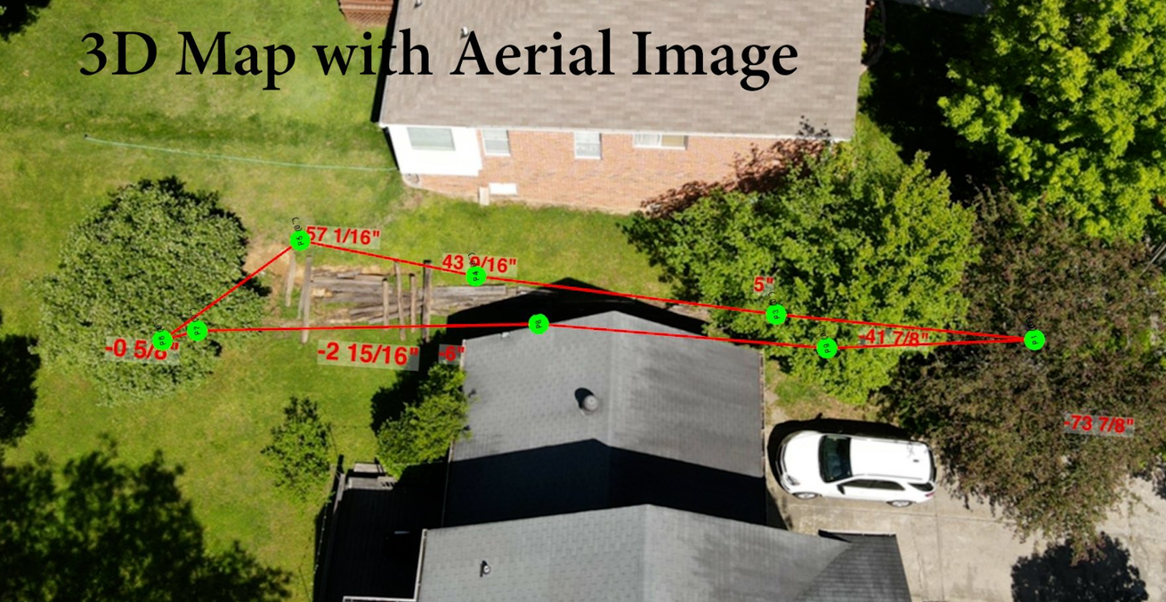
Image Mapping for Home Inspection & Foundation Repair
Just upload a photo to our free app, and Smart Level does the rest!
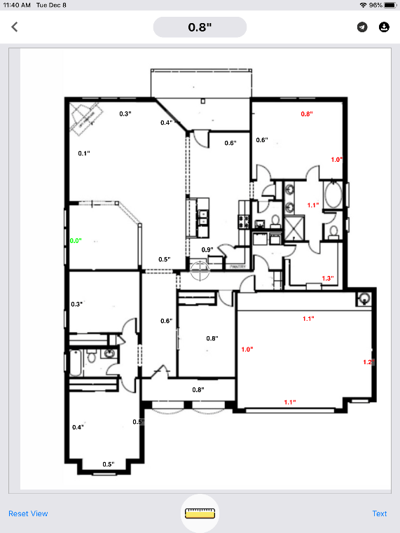
THE SMART LEVEL APP MAKES IMAGE MAPPING EASY
The app is where the magic happens! Just take a photo and the Smart Level will do all of the image mapping!
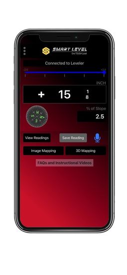
Special Functions Include:
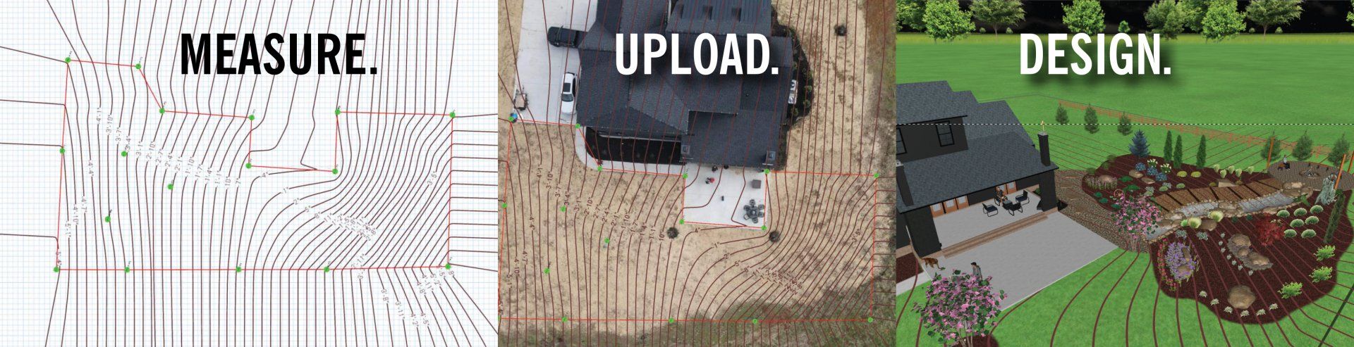
- 3D Terrain Mapping
- Image Mapping
- % of Slope
- Engineering Scale - Ft. Above Sea Level
- Range - Lights Display Low, High, Level
- Compress Data in Zip Files
- Compass
- Audible Function - App will Speak Readings
- FAQ Button
SMART LEVEL WILL SURVEY & MAP TERRAIN FOR UPLOAD TO CAD
Never needs factory re-charge or factory calibration.
TESTIMONIALS
“With the Smart Leveler, our engineers are able to gather accurate relative elevation measurements in a very timely fashion, especially when having to navigate through heavily furnished buildings or buildings with a significant amount of partitions.”
Asher Cohen, Professional Engineer, U.S. Forensic
“We’ve used Smart Leveler for the past 13 years. It gives us a way to differentiate our business from competitors. It has proven to be a valuable tool for our business. In the aftermath of Hurricane Katrina, we used the Smart Leveler to prove to insurance companies there had been a significant shifting of foundations, arbitrating any claim denials.”
Damon O’Donnell, A Pro Home Inspections, Gulf Breeze, FL
“Our crews use Smart Leveler for initial site prep and to level foundations, slabs and decks. My plumbers use it to establish grade for drain fields and landscape subs use it to level retaining walls and patios. I can’t think of a tradesman that wouldn’t benefit for having this tool to guarantee the accuracy of his work and compliance with building codes.“
Bill DuBois, General Contractor, Dubolt Construction, Nashville, TN
